
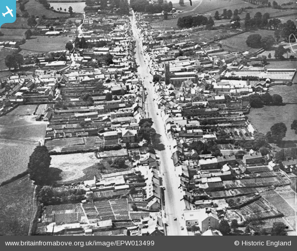
EPW013499 ENGLAND (1925). The High Street, Honiton, 1925. This image has been produced from a copy-negative.
© Copyright OpenStreetMap contributors and licensed by the OpenStreetMap Foundation. 2026. Cartography is licensed as CC BY-SA.
Nearby Images (5)
EPW013499

EPW023224

EPW013500

EPW023225

EAW051931

Details
| Title | [EPW013499] The High Street, Honiton, 1925. This image has been produced from a copy-negative. |
| Reference | EPW013499 |
| Date | June-1925 |
| Link | |
| Place name | HONITON |
| Parish | HONITON |
| District | |
| Country | ENGLAND |
| Easting / Northing | 316458, 100748 |
| Longitude / Latitude | -3.1856062840659, 50.7996990861 |
| National Grid Reference | ST165007 |
Pins
Be the first to add a comment to this image!