
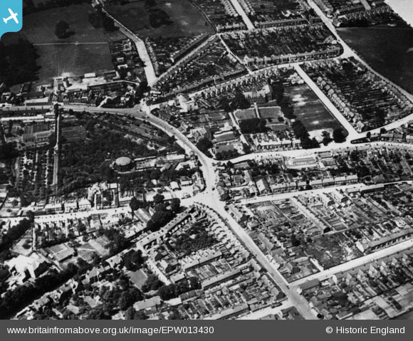
EPW013430 ENGLAND (1925). Nightingale Road and environs, Hitchin, 1925. This image has been produced from a print.
© Copyright OpenStreetMap contributors and licensed by the OpenStreetMap Foundation. 2026. Cartography is licensed as CC BY-SA.
Nearby Images (2)
EPW013430

EPW009820

Details
| Title | [EPW013430] Nightingale Road and environs, Hitchin, 1925. This image has been produced from a print. |
| Reference | EPW013430 |
| Date | June-1925 |
| Link | |
| Place name | HITCHIN |
| Parish | |
| District | |
| Country | ENGLAND |
| Easting / Northing | 518769, 229782 |
| Longitude / Latitude | -0.27151335714113, 51.953397934982 |
| National Grid Reference | TL188298 |
Pins

Bill |
Saturday 22nd of July 2023 03:52:58 PM | |
|
jamsheep |
Saturday 9th of January 2016 12:03:51 PM | |
|
jamsheep |
Saturday 9th of January 2016 12:01:14 PM | |
|
jamsheep |
Saturday 9th of January 2016 11:59:50 AM | |
|
jamsheep |
Saturday 9th of January 2016 11:57:58 AM | |
|
jamsheep |
Saturday 9th of January 2016 11:56:54 AM | |
|
jamsheep |
Saturday 9th of January 2016 11:55:57 AM | |
|
jamsheep |
Saturday 9th of January 2016 11:50:58 AM | |
|
jamsheep |
Saturday 9th of January 2016 11:49:41 AM | |
|
Lozza |
Sunday 6th of September 2015 12:42:25 PM | |
|
Lozza |
Sunday 6th of September 2015 12:41:40 PM | |
This is not York Road, but Bunyan Road |
jamsheep |
Saturday 9th of January 2016 11:50:15 AM |
|
arryboy |
Friday 26th of December 2014 02:35:34 PM | |
|
arryboy |
Monday 24th of November 2014 03:08:09 PM | |
|
arryboy |
Monday 24th of November 2014 03:07:12 PM | |
|
arryboy |
Monday 24th of November 2014 03:06:44 PM |