
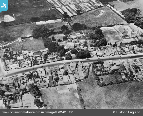
EPW013421 ENGLAND (1925). The High Street, Potters Bar, 1925. This image has been produced from a copy-negative.
© Copyright OpenStreetMap contributors and licensed by the OpenStreetMap Foundation. 2026. Cartography is licensed as CC BY-SA.
Nearby Images (3)
EPW013421

EAW043440

EAW043441

Details
| Title | [EPW013421] The High Street, Potters Bar, 1925. This image has been produced from a copy-negative. |
| Reference | EPW013421 |
| Date | June-1925 |
| Link | |
| Place name | POTTERS BAR |
| Parish | |
| District | |
| Country | ENGLAND |
| Easting / Northing | 525995, 200989 |
| Longitude / Latitude | -0.17688623715634, 51.693032565822 |
| National Grid Reference | TL260010 |
Pins

arryboy |
Tuesday 9th of December 2014 09:51:53 AM | |
|
arryboy |
Thursday 13th of November 2014 10:44:42 AM | |
|
arryboy |
Thursday 13th of November 2014 10:41:32 AM | |
|
arryboy |
Thursday 13th of November 2014 10:40:01 AM | |
|
arryboy |
Thursday 13th of November 2014 10:39:31 AM |
User Comment Contributions
Ladbrooke Schhol |
arryboy |
Thursday 13th of November 2014 10:40:56 AM |