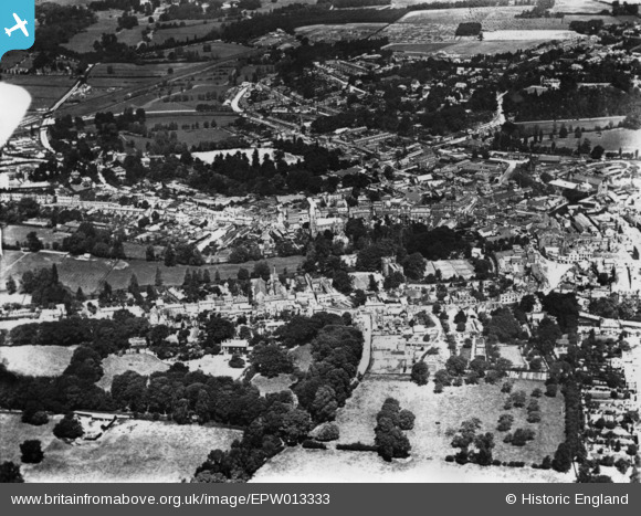
EPW013333 ENGLAND (1925). The castle and town, Hertford, 1925. This image has been produced from a print.
© Copyright OpenStreetMap contributors and licensed by the OpenStreetMap Foundation. 2026. Cartography is licensed as CC BY-SA.
Details
| Title | [EPW013333] The castle and town, Hertford, 1925. This image has been produced from a print. |
| Reference | EPW013333 |
| Date | June-1925 |
| Link | |
| Place name | HERTFORD |
| Parish | HERTFORD |
| District | |
| Country | ENGLAND |
| Easting / Northing | 532348, 212544 |
| Longitude / Latitude | -0.08061697337802, 51.795416381176 |
| National Grid Reference | TL323125 |
Pins

John W |
Sunday 31st of July 2016 07:08:40 PM | |

John W |
Sunday 31st of July 2016 07:05:38 PM | |

John W |
Sunday 31st of July 2016 07:05:04 PM | |

Class31 |
Friday 28th of November 2014 05:22:37 PM | |

Class31 |
Friday 28th of November 2014 05:20:25 PM | |

Class31 |
Friday 28th of November 2014 05:18:53 PM |


![[EPW013333] The castle and town, Hertford, 1925. This image has been produced from a print.](http://britainfromabove.org.uk/sites/all/libraries/aerofilms-images/public/100x100/EPW/013/EPW013333.jpg)
![[EAW022371] The town, Hertford, from the north-west, 1949](http://britainfromabove.org.uk/sites/all/libraries/aerofilms-images/public/100x100/EAW/022/EAW022371.jpg)
![[EAW022370] Hertford Castle and the town, Hertford, 1949](http://britainfromabove.org.uk/sites/all/libraries/aerofilms-images/public/100x100/EAW/022/EAW022370.jpg)
![[EPW013328] St Andrew Street and environs, Hertford, 1925. This image has been produced from a copy-negative.](http://britainfromabove.org.uk/sites/all/libraries/aerofilms-images/public/100x100/EPW/013/EPW013328.jpg)