
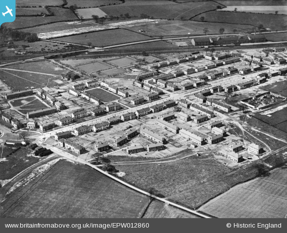
EPW012860 ENGLAND (1925). The residential area surrounding St Helen's Square, Prince's Square and Lancaster Avenue, Kirk Sandall, 1925. This image has been produced from a copy-negative.
© Copyright OpenStreetMap contributors and licensed by the OpenStreetMap Foundation. 2026. Cartography is licensed as CC BY-SA.
Nearby Images (2)
EPW012860

EPW012859

Details
| Title | [EPW012860] The residential area surrounding St Helen's Square, Prince's Square and Lancaster Avenue, Kirk Sandall, 1925. This image has been produced from a copy-negative. |
| Reference | EPW012860 |
| Date | May-1925 |
| Link | |
| Place name | KIRK SANDALL |
| Parish | BARNBY DUN WITH KIRK SANDALL |
| District | |
| Country | ENGLAND |
| Easting / Northing | 461846, 407861 |
| Longitude / Latitude | -1.0661393005771, 53.563472559689 |
| National Grid Reference | SE618079 |
Pins
Be the first to add a comment to this image!