
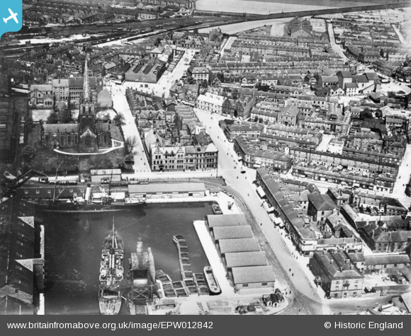
EPW012842 ENGLAND (1925). St John's Church, Aire Street and the town centre, Goole, 1925. This image has been produced from a copy-negative.
© Copyright OpenStreetMap contributors and licensed by the OpenStreetMap Foundation. 2026. Cartography is licensed as CC BY-SA.
Nearby Images (6)
EPW012842

EPW031440

EPW012839

EAW046151

EPW031441

EPW031431

Details
| Title | [EPW012842] St John's Church, Aire Street and the town centre, Goole, 1925. This image has been produced from a copy-negative. |
| Reference | EPW012842 |
| Date | May-1925 |
| Link | |
| Place name | GOOLE |
| Parish | GOOLE |
| District | |
| Country | ENGLAND |
| Easting / Northing | 474651, 423447 |
| Longitude / Latitude | -0.86908420437488, 53.701886473763 |
| National Grid Reference | SE747234 |
Pins
Be the first to add a comment to this image!