
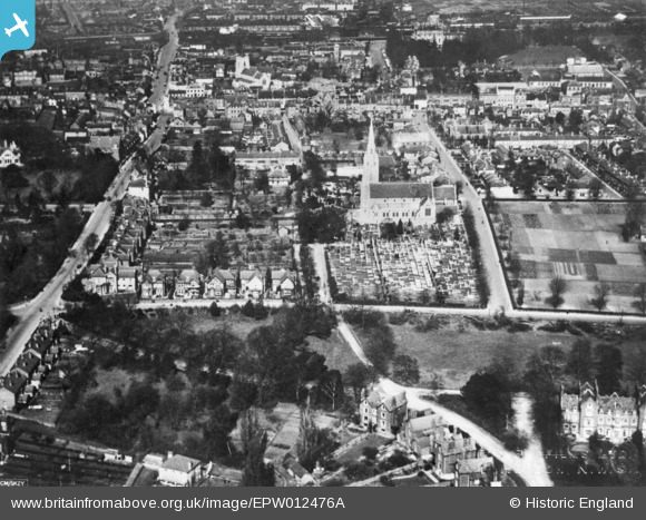
EPW012476A ENGLAND (1925). St Mary's Church and environs, Slough, 1925. This image has been produced from a copy-negative.
© Copyright OpenStreetMap contributors and licensed by the OpenStreetMap Foundation. 2026. Cartography is licensed as CC BY-SA.
Nearby Images (7)
EPW012476A

EPW056576

EPW012476

EPR000475

EAW029472

EPW012477

EPW056580

Details
| Title | [EPW012476A] St Mary's Church and environs, Slough, 1925. This image has been produced from a copy-negative. |
| Reference | EPW012476A |
| Date | April-1925 |
| Link | |
| Place name | SLOUGH |
| Parish | |
| District | |
| Country | ENGLAND |
| Easting / Northing | 497563, 179566 |
| Longitude / Latitude | -0.59409652022283, 51.506110902839 |
| National Grid Reference | SU976796 |
Pins

sciencefish |
Wednesday 3rd of February 2021 10:08:11 PM | |

Class31 |
Friday 18th of September 2015 11:29:32 AM | |
|
dave43 |
Friday 2nd of January 2015 09:07:28 PM |
