
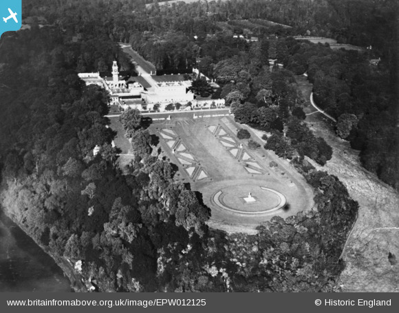
EPW012125 ENGLAND (1924). Cliveden, Taplow, 1924. This image has been produced from a copy-negative.
© Copyright OpenStreetMap contributors and licensed by the OpenStreetMap Foundation. 2026. Cartography is licensed as CC BY-SA.
Nearby Images (12)
EPW012125

EAW042177

EPW005699

EAW013944

EAW013945

EAW013946

EPW005698

EPW056584

EAW042176

EAW013947

EPW012126

EPW022618

Details
| Title | [EPW012125] Cliveden, Taplow, 1924. This image has been produced from a copy-negative. |
| Reference | EPW012125 |
| Date | September-1924 |
| Link | |
| Place name | TAPLOW |
| Parish | TAPLOW |
| District | |
| Country | ENGLAND |
| Easting / Northing | 491004, 185039 |
| Longitude / Latitude | -0.68717075563699, 51.556408294381 |
| National Grid Reference | SU910850 |
Pins
Be the first to add a comment to this image!