
EPW011715 ENGLAND (1924). Glastonbury Tor, Glastonbury, 1924. This image has been produced from a damaged copy-negative.

© Copyright OpenStreetMap contributors and licensed by the OpenStreetMap Foundation. 2026. Cartography is licensed as CC BY-SA.
Nearby Images (4)
EPW011715

EAW002948

EPW011714

EAW002949

Details
| Title | [EPW011715] Glastonbury Tor, Glastonbury, 1924. This image has been produced from a damaged copy-negative. |
| Reference | EPW011715 |
| Date | 10-September-1924 |
| Link | |
| Place name | GLASTONBURY |
| Parish | GLASTONBURY |
| District | |
| Country | ENGLAND |
| Easting / Northing | 351241, 138628 |
| Longitude / Latitude | -2.697108597758, 51.144312997855 |
| National Grid Reference | ST512386 |
Pins
Be the first to add a comment to this image!
User Comment Contributions

St Michael's Tower on Tor Hill, Glastonbury Tor, Glastonbury, 22/07/2014 |

Class31 |
Saturday 17th of January 2015 07:27:56 AM |

St Michael's Tower on Tor Hill, Glastonbury Tor, Glastonbury, 22/07/2014 |
Class31 |
Saturday 17th of January 2015 07:27:14 AM |
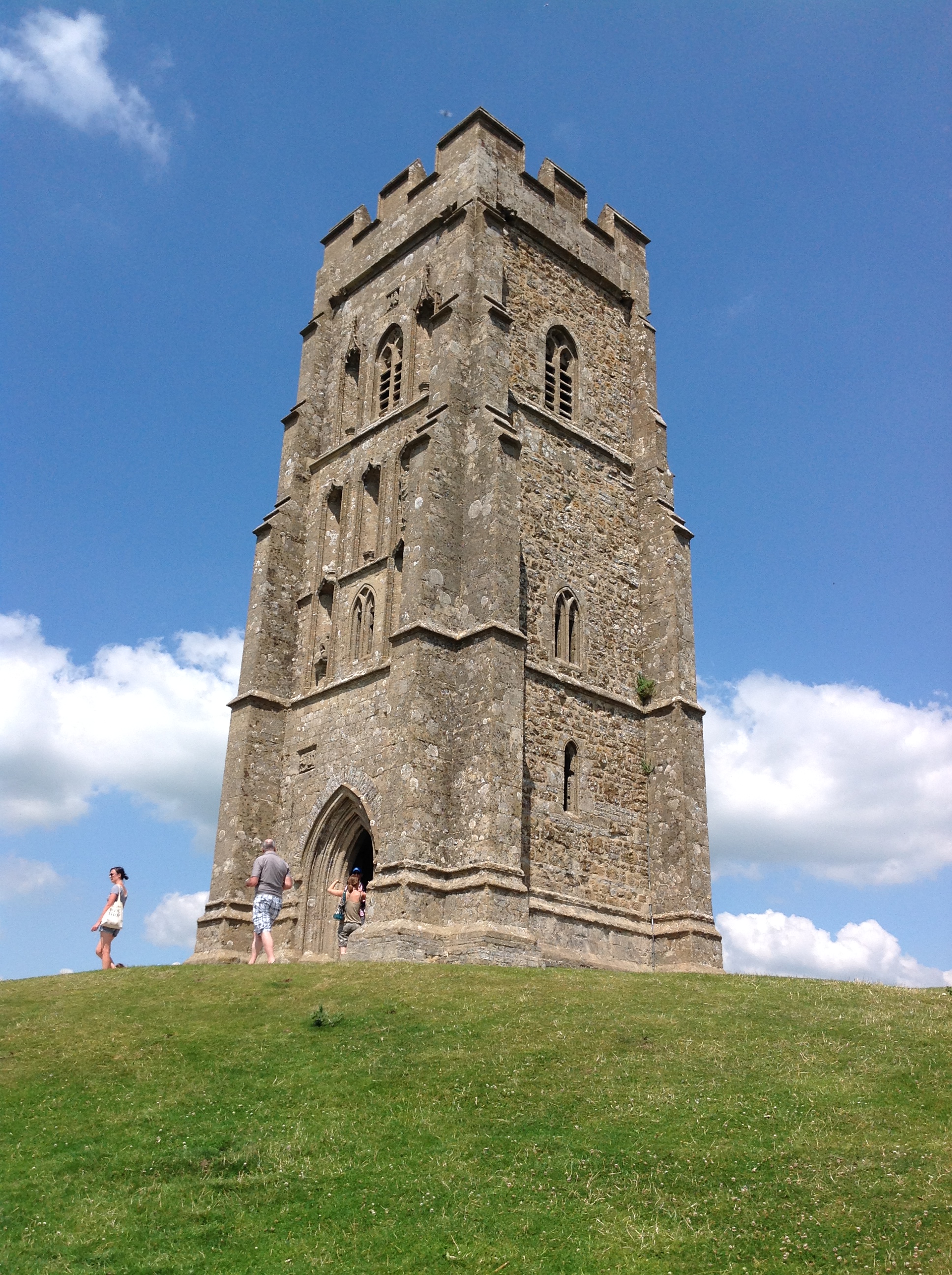
St Michael's Tower on Tor Hill, Glastonbury Tor, Glastonbury, 22/07/2014 |
Class31 |
Saturday 17th of January 2015 07:26:49 AM |

From St Michael's Tower on Tor Hill, Glastonbury Tor, Glastonbury, 22/07/2014 |
Class31 |
Saturday 17th of January 2015 07:25:40 AM |

From St Michael's Tower on Tor Hill, Glastonbury Tor, Glastonbury, 22/07/2014 |
Class31 |
Saturday 17th of January 2015 07:24:28 AM |