
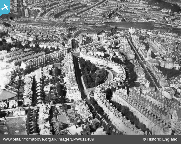
EPW011489 ENGLAND (1924). Montpelier Crescent, Seven Dials and the surrounding residential area, Brighton, 1924. This image has been produced from a copy-negative.
© Copyright OpenStreetMap contributors and licensed by the OpenStreetMap Foundation. 2026. Cartography is licensed as CC BY-SA.
Nearby Images (2)
EPW011489

EPW045502

Details
| Title | [EPW011489] Montpelier Crescent, Seven Dials and the surrounding residential area, Brighton, 1924. This image has been produced from a copy-negative. |
| Reference | EPW011489 |
| Date | July-1924 |
| Link | |
| Place name | BRIGHTON |
| Parish | |
| District | |
| Country | ENGLAND |
| Easting / Northing | 530502, 105016 |
| Longitude / Latitude | -0.14673649516991, 50.829389938517 |
| National Grid Reference | TQ305050 |
Pins

bugbear |
Monday 23rd of February 2015 01:14:45 PM | |
|
bugbear |
Monday 23rd of February 2015 01:06:14 PM | |
|
bugbear |
Monday 23rd of February 2015 12:58:27 PM | |
|
bugbear |
Monday 23rd of February 2015 12:57:51 PM | |
|
bugbear |
Monday 23rd of February 2015 12:56:17 PM | |

Alan McFaden |
Tuesday 7th of October 2014 01:10:40 PM |

User Comment Contributions
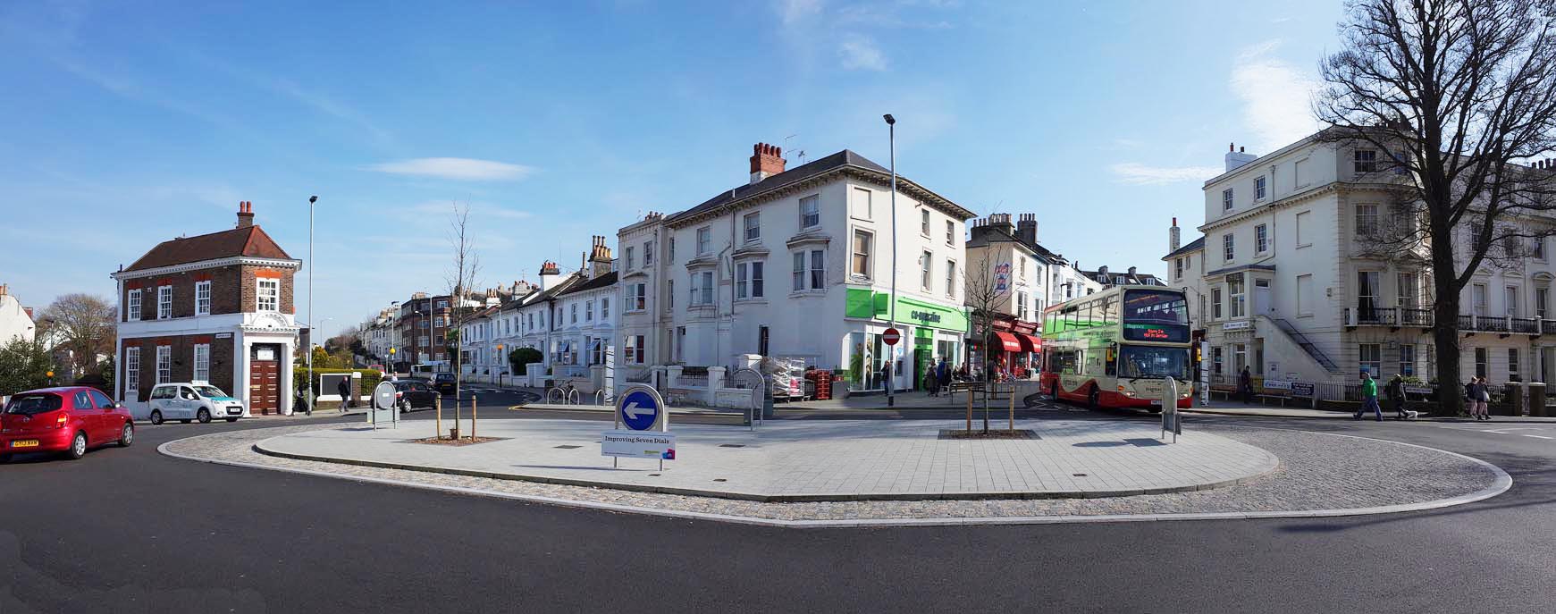
Brighton Seven Dials New Road Layout 2014 |
Alan McFaden |
Tuesday 7th of October 2014 01:16:48 PM |