
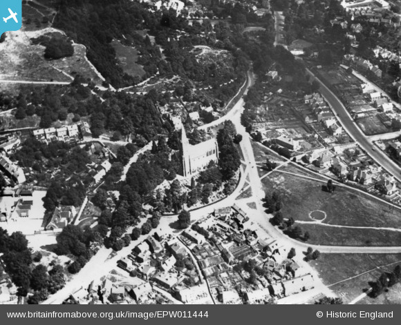
EPW011444 ENGLAND (1924). St John's Church, Reigate, 1924. This image has been produced from a print.
© Copyright OpenStreetMap contributors and licensed by the OpenStreetMap Foundation. 2026. Cartography is licensed as CC BY-SA.
Nearby Images (2)
EPW011444

EAW018648

Details
| Title | [EPW011444] St John's Church, Reigate, 1924. This image has been produced from a print. |
| Reference | EPW011444 |
| Date | July-1924 |
| Link | |
| Place name | REIGATE |
| Parish | |
| District | |
| Country | ENGLAND |
| Easting / Northing | 527420, 149377 |
| Longitude / Latitude | -0.17488173324226, 51.228824566265 |
| National Grid Reference | TQ274494 |
Pins
Be the first to add a comment to this image!