
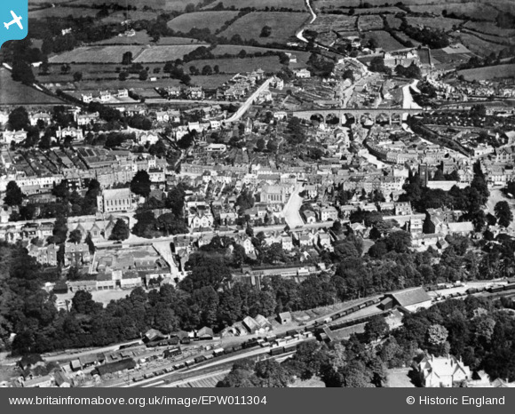
EPW011304 ENGLAND (1924). Russell Street and environs, Tavistock, 1924. This image has been produced from a copy-negative.
© Copyright OpenStreetMap contributors and licensed by the OpenStreetMap Foundation. 2026. Cartography is licensed as CC BY-SA.
Nearby Images (8)
EPW011304

EPW023595

EPW023596

EPW023599

EPW023605

EPW011306

EPW023604

EPW023606

Details
| Title | [EPW011304] Russell Street and environs, Tavistock, 1924. This image has been produced from a copy-negative. |
| Reference | EPW011304 |
| Date | July-1924 |
| Link | |
| Place name | TAVISTOCK |
| Parish | TAVISTOCK |
| District | |
| Country | ENGLAND |
| Easting / Northing | 247984, 74348 |
| Longitude / Latitude | -4.1459539076175, 50.548513672258 |
| National Grid Reference | SX480743 |
Pins

John W |
Monday 24th of May 2021 04:45:34 PM | |
|
John W |
Monday 24th of May 2021 04:44:24 PM | |
|
John W |
Monday 24th of May 2021 04:39:07 PM | |
|
LionStevieG |
Saturday 26th of December 2015 01:03:31 PM | |
|
LionStevieG |
Saturday 26th of December 2015 12:52:46 PM | |
|
LionStevieG |
Saturday 26th of December 2015 12:52:25 PM | |
|
LionStevieG |
Saturday 26th of December 2015 12:51:12 PM | |
|
LionStevieG |
Saturday 26th of December 2015 12:46:57 PM | |
|
LionStevieG |
Saturday 26th of December 2015 12:45:22 PM |