
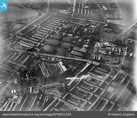
EPW011166 ENGLAND (1924). The Linacre Gas Works, Bootle, 1924
© Copyright OpenStreetMap contributors and licensed by the OpenStreetMap Foundation. 2026. Cartography is licensed as CC BY-SA.
Nearby Images (5)
EPW011166

EPW011164

EPW011165

EPW011167

EPW011168

Details
| Title | [EPW011166] The Linacre Gas Works, Bootle, 1924 |
| Reference | EPW011166 |
| Date | July-1924 |
| Link | |
| Place name | BOOTLE |
| Parish | |
| District | |
| Country | ENGLAND |
| Easting / Northing | 334563, 395902 |
| Longitude / Latitude | -2.9855782927163, 53.455548158255 |
| National Grid Reference | SJ346959 |
Pins

Lord Axminister |
Tuesday 22nd of July 2025 03:00:16 PM | |
|
Lord Axminister |
Tuesday 22nd of July 2025 02:58:51 PM | |
|
Lord Axminister |
Thursday 5th of June 2025 09:54:24 PM | |
|
Lord Axminister |
Thursday 5th of June 2025 09:53:26 PM | |
|
Ange |
Thursday 2nd of February 2023 11:50:48 AM | |
|
alan |
Monday 6th of April 2020 01:11:02 AM | |
|
Ronnie |
Wednesday 14th of September 2016 11:42:24 AM | |
|
Lord Axminister |
Tuesday 17th of May 2016 08:29:43 PM | |
|
Lord Axminister |
Tuesday 17th of May 2016 08:27:28 PM | |
|
Lord Axminister |
Tuesday 17th of May 2016 08:23:56 PM | |
|
Ange |
Friday 24th of January 2014 10:53:10 PM | |
|
Ange |
Friday 24th of January 2014 10:50:18 PM | |
|
Ange |
Friday 24th of January 2014 10:49:12 PM |