
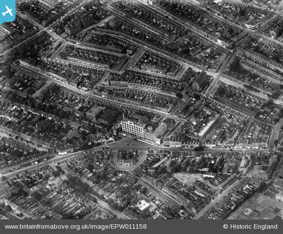
EPW011158 ENGLAND (1924). Wells Crescent and environs, Camberwell, 1924
© Copyright OpenStreetMap contributors and licensed by the OpenStreetMap Foundation. 2026. Cartography is licensed as CC BY-SA.
Nearby Images (6)
EPW011158

EPW010166

EPW011157

EPW011159

EPW010160

EPW010956

Details
| Title | [EPW011158] Wells Crescent and environs, Camberwell, 1924 |
| Reference | EPW011158 |
| Date | July-1924 |
| Link | |
| Place name | CAMBERWELL |
| Parish | |
| District | |
| Country | ENGLAND |
| Easting / Northing | 533440, 177186 |
| Longitude / Latitude | -0.078272136064776, 51.477387468263 |
| National Grid Reference | TQ334772 |
Pins

oakwood |
Friday 26th of July 2013 08:02:10 PM |
User Comment Contributions

My grandfather and grandmother lived at 21 Wells Crescent until they were bombed out in the blitz; I am not sure that Wells Crescent was in fact here other than that WC was completely demolished (does not exist today) and all the talk when I was young about Samuel Jones - the Butterfly Company and Southampton Way. The latter building I can remember with the enormous butterfly on the front – not visible in this picture so I guess added much later, after the war. |
Rnornan345 |
Monday 14th of November 2016 12:49:06 PM |