
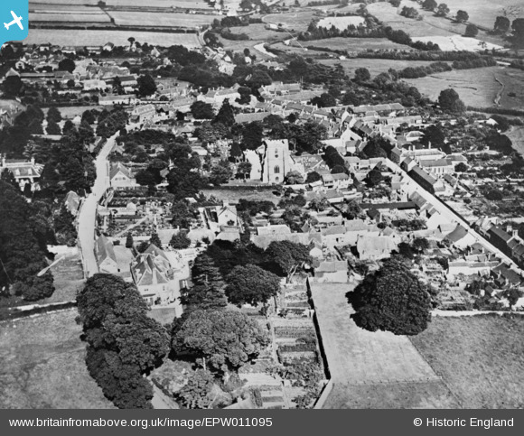
EPW011095 ENGLAND (1924). The village, Ramsbury, 1924. This image has been produced from a copy-negative.
© Copyright OpenStreetMap contributors and licensed by the OpenStreetMap Foundation. 2025. Cartography is licensed as CC BY-SA.
Nearby Images (3)
EPW011095

EPW011094

EPW011134

Details
| Title | [EPW011095] The village, Ramsbury, 1924. This image has been produced from a copy-negative. |
| Reference | EPW011095 |
| Date | July-1924 |
| Link | |
| Place name | RAMSBURY |
| Parish | RAMSBURY |
| District | |
| Country | ENGLAND |
| Easting / Northing | 427303, 171597 |
| Longitude / Latitude | -1.6071154128336, 51.442216432305 |
| National Grid Reference | SU273716 |
Pins
Be the first to add a comment to this image!