
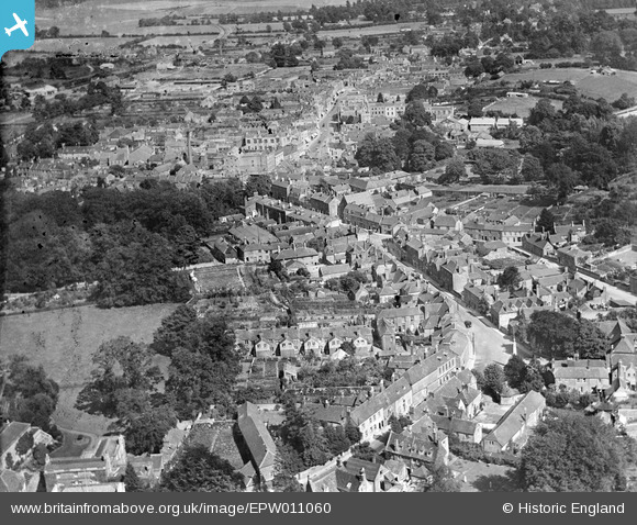
EPW011060 ENGLAND (1924). View along Silver Street, George Street and High Street, Warminster, from the north-west, 1924
© Copyright OpenStreetMap contributors and licensed by the OpenStreetMap Foundation. 2026. Cartography is licensed as CC BY-SA.
Nearby Images (3)
EPW011060

EPW027667

EPW027658

Details
| Title | [EPW011060] View along Silver Street, George Street and High Street, Warminster, from the north-west, 1924 |
| Reference | EPW011060 |
| Date | July-1924 |
| Link | |
| Place name | WARMINSTER |
| Parish | WARMINSTER |
| District | |
| Country | ENGLAND |
| Easting / Northing | 386957, 145193 |
| Longitude / Latitude | -2.1867212632562, 51.205280446302 |
| National Grid Reference | ST870452 |
Pins

Class31 |
Friday 17th of May 2013 08:56:46 AM | |
|
Class31 |
Friday 17th of May 2013 08:50:53 AM | |
|
Class31 |
Friday 17th of May 2013 08:49:41 AM | |
|
Class31 |
Friday 17th of May 2013 08:48:42 AM | |
|
Class31 |
Friday 17th of May 2013 08:48:23 AM | |
|
Class31 |
Friday 17th of May 2013 08:47:26 AM |