
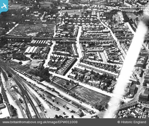
EPW011008 ENGLAND (1924). Lyson's Road and the surrounding area, Aldershot, 1924. This image has been produced from a print affected by flare.
© Copyright OpenStreetMap contributors and licensed by the OpenStreetMap Foundation. 2026. Cartography is licensed as CC BY-SA.
Nearby Images (6)
EPW011008

EPW056802

EPW056803

EPW056799

EPW056798

EPW056800

Details
| Title | [EPW011008] Lyson's Road and the surrounding area, Aldershot, 1924. This image has been produced from a print affected by flare. |
| Reference | EPW011008 |
| Date | July-1924 |
| Link | |
| Place name | ALDERSHOT |
| Parish | |
| District | |
| Country | ENGLAND |
| Easting / Northing | 486381, 150384 |
| Longitude / Latitude | -0.76228465494438, 51.245568039865 |
| National Grid Reference | SU864504 |
Pins
Be the first to add a comment to this image!