
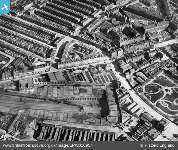
EPW010954 ENGLAND (1924). Caledonian Road and environs, Islington, 1924. This image has been produced from a copy-negative.
© Copyright OpenStreetMap contributors and licensed by the OpenStreetMap Foundation. 2025. Cartography is licensed as CC BY-SA.
Nearby Images (2)
EPW010954

EPW005751A

Details
| Title | [EPW010954] Caledonian Road and environs, Islington, 1924. This image has been produced from a copy-negative. |
| Reference | EPW010954 |
| Date | June-1924 |
| Link | |
| Place name | ISLINGTON |
| Parish | |
| District | |
| Country | ENGLAND |
| Easting / Northing | 530573, 184837 |
| Longitude / Latitude | -0.11670255677508, 51.546820995975 |
| National Grid Reference | TQ306848 |
Pins

billyfern |
Saturday 4th of October 2014 04:54:50 PM | |
|
billyfern |
Saturday 4th of October 2014 10:10:14 AM | |
|
billyfern |
Saturday 4th of October 2014 10:09:32 AM | |
|
billyfern |
Saturday 4th of October 2014 10:09:06 AM | |
|
billyfern |
Saturday 4th of October 2014 10:07:50 AM | |
|
billyfern |
Saturday 4th of October 2014 10:07:23 AM | |
|
Chelsea61 |
Wednesday 1st of October 2014 01:17:56 PM |