
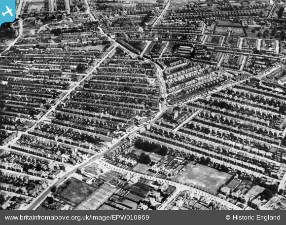
EPW010869 ENGLAND (1924). London Road and West Road, Southend-on-Sea, 1924. This image has been produced from a copy-negative.
© Copyright OpenStreetMap contributors and licensed by the OpenStreetMap Foundation. 2026. Cartography is licensed as CC BY-SA.
Nearby Images (2)
EPW010869

EPW000542

Details
| Title | [EPW010869] London Road and West Road, Southend-on-Sea, 1924. This image has been produced from a copy-negative. |
| Reference | EPW010869 |
| Date | July-1924 |
| Link | |
| Place name | SOUTHEND-ON-SEA |
| Parish | |
| District | |
| Country | ENGLAND |
| Easting / Northing | 586788, 186274 |
| Longitude / Latitude | 0.69404849945836, 51.543923992365 |
| National Grid Reference | TQ868863 |
Pins
Be the first to add a comment to this image!