
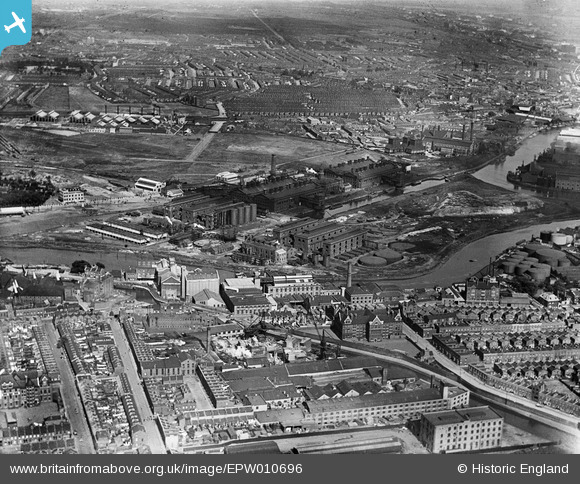
EPW010696 ENGLAND (1924). The Bromley-by-Bow Gas Works and environs, Canning Town, 1924
© Copyright OpenStreetMap contributors and licensed by the OpenStreetMap Foundation. 2026. Cartography is licensed as CC BY-SA.
Nearby Images (4)
EPW010696

EPW010698

EPW010697

EPW010699

Details
| Title | [EPW010696] The Bromley-by-Bow Gas Works and environs, Canning Town, 1924 |
| Reference | EPW010696 |
| Date | June-1924 |
| Link | |
| Place name | CANNING TOWN |
| Parish | |
| District | |
| Country | ENGLAND |
| Easting / Northing | 538355, 182099 |
| Longitude / Latitude | -0.0056073808968244, 51.520359996858 |
| National Grid Reference | TQ384821 |
Pins

Chaz |
Sunday 8th of June 2025 05:39:09 PM | |
|
Chaz |
Sunday 8th of June 2025 05:37:50 PM | |
|
Chaz |
Sunday 8th of June 2025 05:34:02 PM | |
|
Chaz |
Sunday 8th of June 2025 05:32:22 PM | |
|
Chaz |
Sunday 8th of June 2025 05:30:51 PM | |
|
Mike Lloyd |
Sunday 25th of June 2017 03:06:05 PM |