
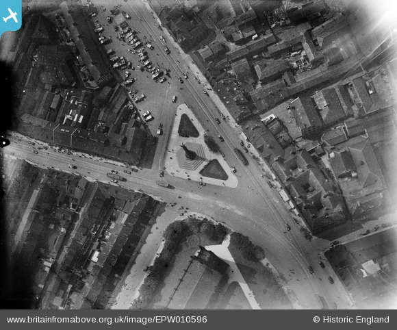
EPW010596 ENGLAND (1924). The South African War Memorial, Newcastle upon Tyne, 1924
© Copyright OpenStreetMap contributors and licensed by the OpenStreetMap Foundation. 2026. Cartography is licensed as CC BY-SA.
Nearby Images (15)
EPW010596

EPW010598

EPW010591

EPW019818

EPW010592

EPW010595

EPW010356

EPW010599

EPW010589

EPW010594

EPW010590

EPW010593

EPW010422A

EPW010597

EPW019886

Details
| Title | [EPW010596] The South African War Memorial, Newcastle upon Tyne, 1924 |
| Reference | EPW010596 |
| Date | 14-June-1924 |
| Link | |
| Place name | NEWCASTLE UPON TYNE |
| Parish | |
| District | |
| Country | ENGLAND |
| Easting / Northing | 424812, 564862 |
| Longitude / Latitude | -1.6122985290407, 54.97767245809 |
| National Grid Reference | NZ248649 |
Pins

PURCELL |
Friday 11th of April 2014 05:22:49 PM | |

Maurice |
Wednesday 13th of November 2013 02:20:02 PM | |
Quite right. This was Haymarket Depot,originally opened in 1878 for horse trams until 13/4 1901 then converted for electric cars and re-opened on 16/12/1901. Closed to trams 17/4/1948 and then used for buses until demolition in 1958. |
mannidaze |
Sunday 25th of October 2015 03:12:46 PM |
Lynda Tubbs |
Wednesday 13th of November 2013 12:20:37 PM | |
For more details on the memorial, see www.roll-of-honour.com/Northumberland/NewcastleBoerWar.html and www.ukniwm.org.uk/server/show/conMemorial.34613/fromUkniwmSearch/1. |

melgibbs |
Wednesday 8th of January 2014 08:14:33 PM |
User Comment Contributions
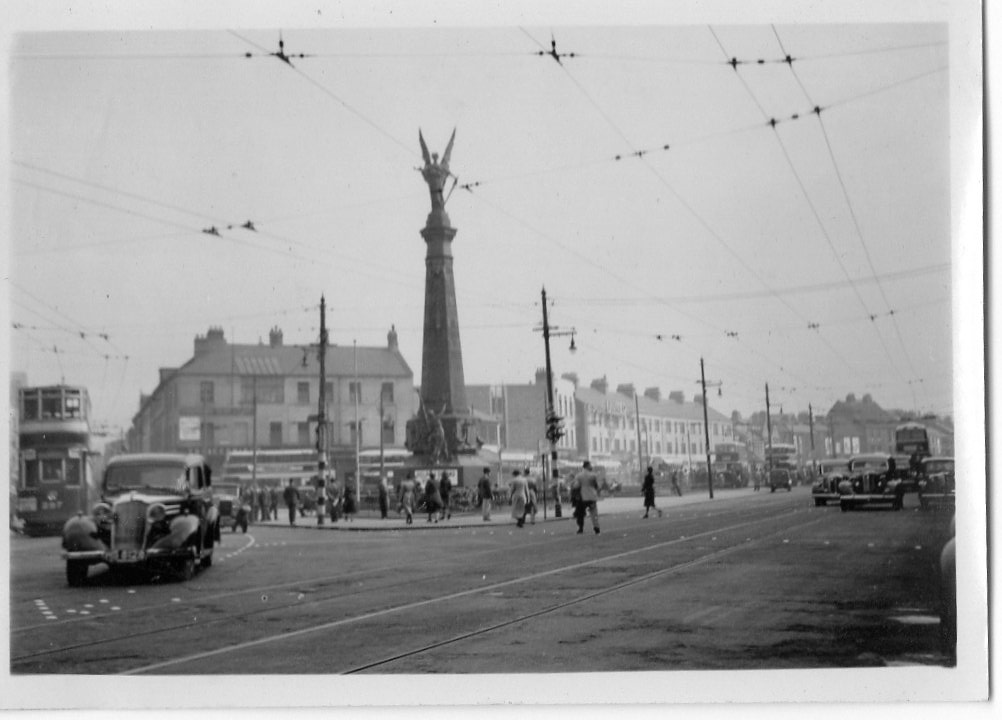
A snapshot of The South African War Memorial taken June or July 1939 marked by the amateur photographer in the album as Haymarket. Can anyone identify a United bus? |

Class31 |
Monday 7th of April 2014 05:21:16 PM |