
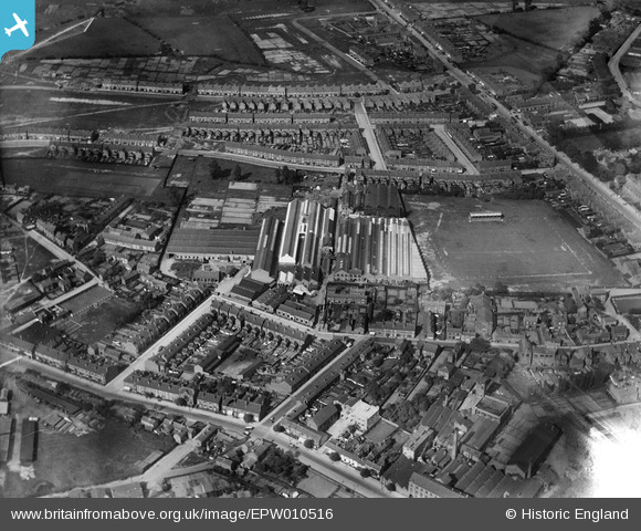
EPW010516 ENGLAND (1924). The Sterling Works and football ground off Station Street, Coventry, 1924
© Copyright OpenStreetMap contributors and licensed by the OpenStreetMap Foundation. 2026. Cartography is licensed as CC BY-SA.
Nearby Images (23)
EPW010516

EPW010576

EPW047703

EPW047708

EPW047710

EPW047698

EPW047706

EPW047711

EPW047699

EPW047705

EPW047702

EPW047704

EPW047700

EPW047701

EPW047707

EPW047709

EPW047716

EPW047717

EPW047718

EPW047719

EPW047715

EPW047712

EPW047714

Details
| Title | [EPW010516] The Sterling Works and football ground off Station Street, Coventry, 1924 |
| Reference | EPW010516 |
| Date | 28-May-1924 |
| Link | |
| Place name | COVENTRY |
| Parish | |
| District | |
| Country | ENGLAND |
| Easting / Northing | 434009, 281640 |
| Longitude / Latitude | -1.4997356889251, 52.431305268972 |
| National Grid Reference | SP340816 |
Pins

John |
Friday 24th of May 2019 11:38:47 AM | |
|
Steve S |
Saturday 11th of May 2019 02:23:45 PM | |
|
Steve S |
Saturday 11th of May 2019 02:20:11 PM | |
|
Steve S |
Saturday 11th of May 2019 02:19:48 PM | |
|
Steve S |
Saturday 11th of May 2019 02:18:26 PM |