
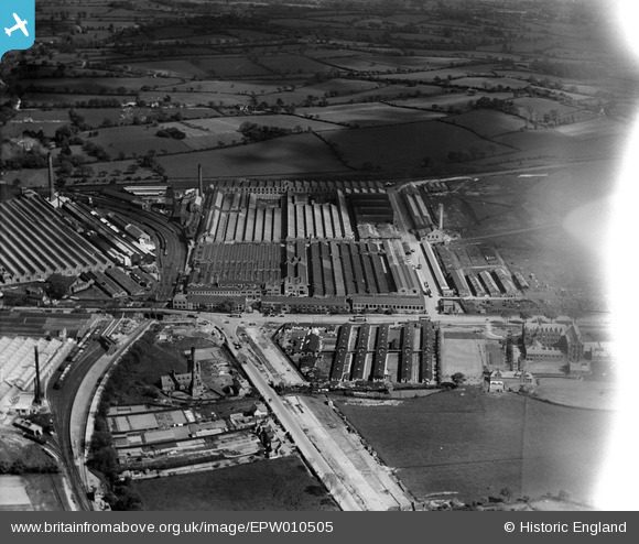
EPW010505 ENGLAND (1924). The Longbridge Motor Works, Longbridge, 1924
© Copyright OpenStreetMap contributors and licensed by the OpenStreetMap Foundation. 2026. Cartography is licensed as CC BY-SA.
Nearby Images (17)
EPW010505

EPW047797

EPW024829

EPW024825

EPW024827

EPW024828

EPW047800

EPW047794

EPW047801

EPW024826

EPW010506

EPW026901

EPW024830

EPW026900

EPW026897

EPW026899

EPW026895

Details
| Title | [EPW010505] The Longbridge Motor Works, Longbridge, 1924 |
| Reference | EPW010505 |
| Date | 28-May-1924 |
| Link | |
| Place name | LONGBRIDGE |
| Parish | |
| District | |
| Country | ENGLAND |
| Easting / Northing | 400936, 277320 |
| Longitude / Latitude | -1.9862434680488, 52.393520967799 |
| National Grid Reference | SP009773 |
Pins

fossil |
Monday 30th of December 2013 02:38:56 PM | |
|
emu-star |
Tuesday 19th of November 2013 01:07:48 AM | |
|
emu-star |
Tuesday 19th of November 2013 01:05:27 AM | |
|
emu-star |
Tuesday 19th of November 2013 01:02:38 AM | |
|
emu-star |
Tuesday 19th of November 2013 12:58:10 AM |