
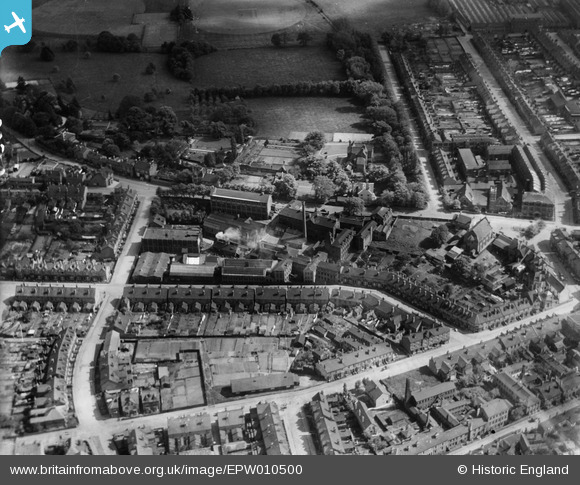
EPW010500 ENGLAND (1924). The Washford Mills (Needles etc) and environs, Redditch, 1924
© Copyright OpenStreetMap contributors and licensed by the OpenStreetMap Foundation. 2024. Cartography is licensed as CC BY-SA.
Nearby Images (4)
EPW010500
 and environs, Redditch, 1924")
EPW010494

EPW014639

EPW010499

Details
| Title | [EPW010500] The Washford Mills (Needles etc) and environs, Redditch, 1924 |
| Reference | EPW010500 |
| Date | 28-May-1924 |
| Link | |
| Place name | REDDITCH |
| Parish | |
| District | |
| Country | ENGLAND |
| Easting / Northing | 404518, 267464 |
| Longitude / Latitude | -1.9337309520853, 52.304885843093 |
| National Grid Reference | SP045675 |
Pins
Be the first to add a comment to this image!