
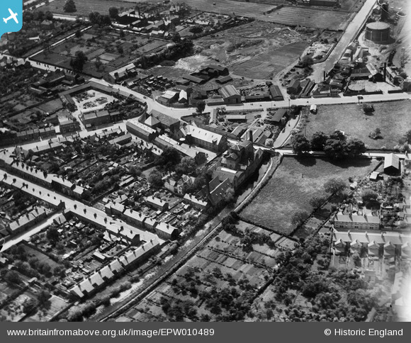
EPW010489 ENGLAND (1924). Brewery Street and environs, Stratford-upon-Avon, 1924
© Copyright OpenStreetMap contributors and licensed by the OpenStreetMap Foundation. 2026. Cartography is licensed as CC BY-SA.
Nearby Images (4)
EPW010489

EPW010478

EAW006657

EPW010484

Details
| Title | [EPW010489] Brewery Street and environs, Stratford-upon-Avon, 1924 |
| Reference | EPW010489 |
| Date | 28-May-1924 |
| Link | |
| Place name | STRATFORD-UPON-AVON |
| Parish | STRATFORD-UPON-AVON |
| District | |
| Country | ENGLAND |
| Easting / Northing | 419969, 255392 |
| Longitude / Latitude | -1.7078149638614, 52.195999037827 |
| National Grid Reference | SP200554 |
Pins

tony |
Friday 20th of May 2016 08:47:16 PM | |
|
tony |
Friday 20th of May 2016 08:45:35 PM | |
|
tony |
Wednesday 4th of March 2015 03:39:53 PM | |
|
tony |
Wednesday 28th of January 2015 03:52:59 PM | |
|
tony |
Wednesday 28th of January 2015 03:52:05 PM | |
|
tony |
Wednesday 28th of January 2015 03:51:06 PM | |
|
tony |
Wednesday 28th of January 2015 03:50:32 PM | |
|
tony |
Wednesday 28th of January 2015 03:49:55 PM |