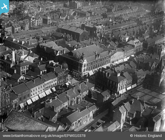
EPW010378 ENGLAND (1924). Junction of Fawcett Street and Bridge Street, Sunderland, 1924
© Copyright OpenStreetMap contributors and licensed by the OpenStreetMap Foundation. 2026. Cartography is licensed as CC BY-SA.
Details
| Title | [EPW010378] Junction of Fawcett Street and Bridge Street, Sunderland, 1924 |
| Reference | EPW010378 |
| Date | April-1924 |
| Link | |
| Place name | SUNDERLAND |
| Parish | |
| District | |
| Country | ENGLAND |
| Easting / Northing | 439734, 557140 |
| Longitude / Latitude | -1.3802146326646, 54.907309974189 |
| National Grid Reference | NZ397571 |
Pins

BBCoaster |
Tuesday 16th of January 2024 05:37:46 PM | |

PinzaC55 |
Friday 28th of February 2020 05:00:01 PM | |

Kate Gill |
Friday 19th of August 2016 10:25:37 AM | |

Jane |
Sunday 14th of February 2016 07:55:58 PM | |

Brigham |
Thursday 26th of November 2015 04:38:49 PM | |

Jane |
Wednesday 8th of April 2015 03:58:38 PM | |
The was originally the Havelock |

mapmaker |
Tuesday 7th of July 2015 11:54:04 PM |
Previously the Havelock Cinema |

Bilberry |
Tuesday 12th of May 2020 05:03:51 PM |
Burnt down in the 60's |

Bilberry |
Tuesday 12th of May 2020 05:04:32 PM |

Peter Harrison |
Wednesday 26th of November 2014 11:50:43 AM | |

Peter Harrison |
Wednesday 26th of November 2014 11:47:59 AM | |

kevin n |
Monday 9th of December 2013 01:53:52 PM |


![[EPW010378] Junction of Fawcett Street and Bridge Street, Sunderland, 1924](http://britainfromabove.org.uk/sites/all/libraries/aerofilms-images/public/100x100/EPW/010/EPW010378.jpg)
![[EPW010360] Robson and Sons Ltd Queen Street Mill and the Wearmouth Bridges, Sunderland, 1924. This image has been produced from a copy-negative.](http://britainfromabove.org.uk/sites/all/libraries/aerofilms-images/public/100x100/EPW/010/EPW010360.jpg)
![[EPW020544] The Wearmouth Bridge and Lambton and Hetton Staiths, Sunderland, from the east, 1928](http://britainfromabove.org.uk/sites/all/libraries/aerofilms-images/public/100x100/EPW/020/EPW020544.jpg)