
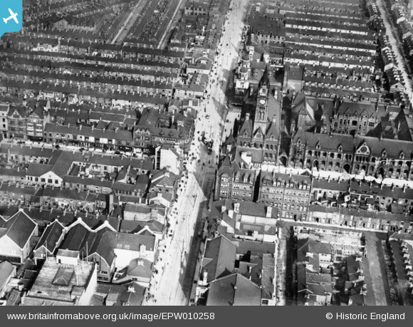
EPW010258 ENGLAND (1924). Corporation Road and the Town Hall, Middlesbrough, 1924. This image has been produced from a copy-negative.
© Copyright OpenStreetMap contributors and licensed by the OpenStreetMap Foundation. 2026. Cartography is licensed as CC BY-SA.
Nearby Images (5)
EPW010258

EPW010124

EPW010120

EPW038954

EPW038952

Details
| Title | [EPW010258] Corporation Road and the Town Hall, Middlesbrough, 1924. This image has been produced from a copy-negative. |
| Reference | EPW010258 |
| Date | April-1924 |
| Link | |
| Place name | MIDDLESBROUGH |
| Parish | |
| District | |
| Country | ENGLAND |
| Easting / Northing | 449583, 520387 |
| Longitude / Latitude | -1.2328676585491, 54.57613794538 |
| National Grid Reference | NZ496204 |
Pins

JessiWewer |
Tuesday 22nd of August 2023 01:14:15 AM | |
|
Charlie |
Wednesday 14th of July 2021 01:16:23 PM | |
|
Charlie |
Wednesday 14th of July 2021 01:13:55 PM | |
|
Charlie |
Wednesday 14th of July 2021 01:12:34 PM | |
|
Charlie |
Wednesday 14th of July 2021 01:10:06 PM | |
|
morbidthepoet |
Friday 4th of January 2019 05:38:22 AM | |
|
morbidthepoet |
Thursday 5th of April 2018 05:55:38 AM |
