
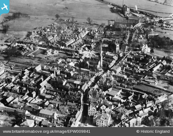
EPW009841 ENGLAND (1924). The High Street and town centre, Huntingdon, 1924. This image has been produced from a copy-negative.
© Copyright OpenStreetMap contributors and licensed by the OpenStreetMap Foundation. 2026. Cartography is licensed as CC BY-SA.
Nearby Images (10)
EPW009841

EPW009849

EAW051768

EAW051770

EAW051769

EPW014430

EPW014431

EPW014427

EAW031902

EAW031903

Details
| Title | [EPW009841] The High Street and town centre, Huntingdon, 1924. This image has been produced from a copy-negative. |
| Reference | EPW009841 |
| Date | March-1924 |
| Link | |
| Place name | HUNTINGDON |
| Parish | HUNTINGDON |
| District | |
| Country | ENGLAND |
| Easting / Northing | 524010, 271746 |
| Longitude / Latitude | -0.17996628938962, 52.329385275455 |
| National Grid Reference | TL240717 |
Pins

alastair wallace |
Monday 19th of October 2015 07:19:52 PM |