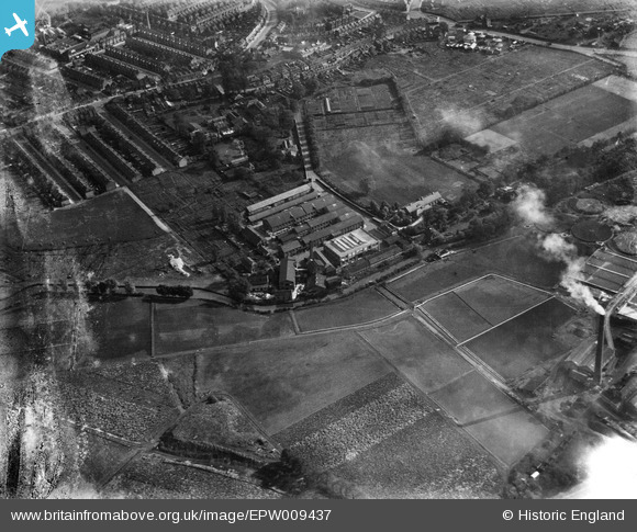
EPW009437 ENGLAND (1923). The Garratt Works, Earlsfield, 1923
© Copyright OpenStreetMap contributors and licensed by the OpenStreetMap Foundation. 2026. Cartography is licensed as CC BY-SA.
Details
| Title | [EPW009437] The Garratt Works, Earlsfield, 1923 |
| Reference | EPW009437 |
| Date | 1923 |
| Link | |
| Place name | EARLSFIELD |
| Parish | |
| District | |
| Country | ENGLAND |
| Easting / Northing | 525892, 172014 |
| Longitude / Latitude | -0.18875520382622, 51.432631638415 |
| National Grid Reference | TQ259720 |
Pins
Be the first to add a comment to this image!


![[EPW009437] The Garratt Works, Earlsfield, 1923](http://britainfromabove.org.uk/sites/all/libraries/aerofilms-images/public/100x100/EPW/009/EPW009437.jpg)
![[EPW009438] The Garratt Works, Earlsfield, 1923](http://britainfromabove.org.uk/sites/all/libraries/aerofilms-images/public/100x100/EPW/009/EPW009438.jpg)
![[EPW009440] The Sewage Works, Wimbledon, 1923](http://britainfromabove.org.uk/sites/all/libraries/aerofilms-images/public/100x100/EPW/009/EPW009440.jpg)
![[EPW010776] Maskell Road and environs, Summerstown, 1924. This image has been produced from a copy-negative.](http://britainfromabove.org.uk/sites/all/libraries/aerofilms-images/public/100x100/EPW/010/EPW010776.jpg)