
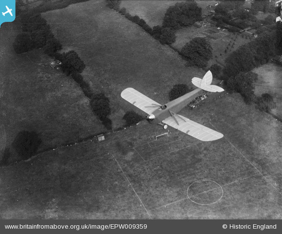
EPW009359 ENGLAND (1923). A De Havilland DH.53 "Humming Bird" in flight over Bacon Lane, Little Stanmore, 1923
© Copyright OpenStreetMap contributors and licensed by the OpenStreetMap Foundation. 2026. Cartography is licensed as CC BY-SA.
Nearby Images (2)
EPW009359

EPW009356

Details
| Title | [EPW009359] A De Havilland DH.53 "Humming Bird" in flight over Bacon Lane, Little Stanmore, 1923 |
| Reference | EPW009359 |
| Date | 1923 |
| Link | |
| Place name | LITTLE STANMORE |
| Parish | |
| District | |
| Country | ENGLAND |
| Easting / Northing | 519347, 191132 |
| Longitude / Latitude | -0.27639693628649, 51.605888974846 |
| National Grid Reference | TQ193911 |
Pins

Class31 |
Tuesday 26th of November 2013 09:19:12 AM | |

Dave Brunt |
Tuesday 25th of June 2013 12:17:23 AM | |
|
Dave Brunt |
Monday 24th of June 2013 11:55:48 PM |
User Comment Contributions
View looking north east |
Class31 |
Wednesday 8th of January 2014 08:44:45 AM |
Hi Class31, Thanks for looking back at this image. We'll update the catalogue and post the new data here in due course. Yours, Katy Britain from Above Cataloguing Team Leader |
Katy Whitaker |
Wednesday 8th of January 2014 08:44:45 AM |
Eureka I believe that I can see this area in EPW009356 which is of Bacon Lane and the Edgware Road, Little Stanmore, 1923 There is a vegetable plot where the patterns of the crops is exactly the same with a cold frame at the east side. |
Class31 |
Tuesday 26th of November 2013 09:15:32 AM |