
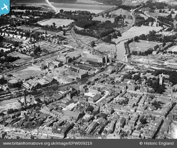
EPW009219 ENGLAND (1923). Acorn Wharf and environs, Maidstone, 1923
© Copyright OpenStreetMap contributors and licensed by the OpenStreetMap Foundation. 2026. Cartography is licensed as CC BY-SA.
Nearby Images (9)
EPW009219

EPW026066

EPW005617

EPW005619

EPW026076

EPW009211

EAW021789

EAW021786

EAW021784

Details
| Title | [EPW009219] Acorn Wharf and environs, Maidstone, 1923 |
| Reference | EPW009219 |
| Date | 1923 |
| Link | |
| Place name | MAIDSTONE |
| Parish | |
| District | |
| Country | ENGLAND |
| Easting / Northing | 575690, 156021 |
| Longitude / Latitude | 0.51916463799205, 51.275698760563 |
| National Grid Reference | TQ757560 |
Pins

Stu Giles |
Tuesday 22nd of May 2018 06:11:37 AM | |
|
JimP |
Wednesday 6th of November 2013 03:57:19 PM |