
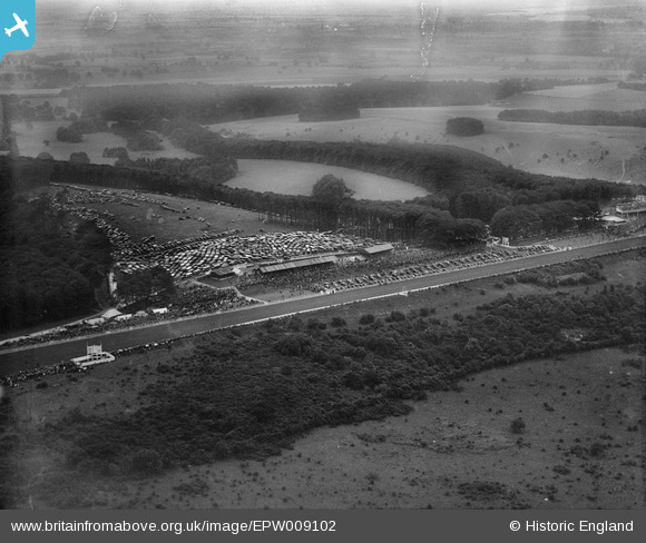
EPW009102 ENGLAND (1923). The Racecourse, Goodwood, 1923
© Copyright OpenStreetMap contributors and licensed by the OpenStreetMap Foundation. 2025. Cartography is licensed as CC BY-SA.
Nearby Images (7)
EPW009102

EPW009101

EAW025052

EAW025050

EAW025054

EAW025049

EAW025051

Details
| Title | [EPW009102] The Racecourse, Goodwood, 1923 |
| Reference | EPW009102 |
| Date | 1923 |
| Link | |
| Place name | GOODWOOD |
| Parish | SINGLETON |
| District | |
| Country | ENGLAND |
| Easting / Northing | 488343, 111022 |
| Longitude / Latitude | -0.74379747341269, 50.89136405594 |
| National Grid Reference | SU883110 |
Pins
Be the first to add a comment to this image!