
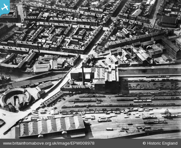
EPW008978 ENGLAND (1923). The Midland Flour Mill, Monument Lane Goods and Coal Depot and environs, Ladywood, 1923. This image has been produced from a copy-negative.
© Copyright OpenStreetMap contributors and licensed by the OpenStreetMap Foundation. 2026. Cartography is licensed as CC BY-SA.
Nearby Images (3)
EPW008978

EAW015326

EPW010030

Details
| Title | [EPW008978] The Midland Flour Mill, Monument Lane Goods and Coal Depot and environs, Ladywood, 1923. This image has been produced from a copy-negative. |
| Reference | EPW008978 |
| Date | July-1923 |
| Link | |
| Place name | LADYWOOD |
| Parish | |
| District | |
| Country | ENGLAND |
| Easting / Northing | 405533, 286811 |
| Longitude / Latitude | -1.9185234798304, 52.478828001449 |
| National Grid Reference | SP055868 |
Pins

edMocass |
Wednesday 22nd of October 2025 03:25:26 PM | |
|
HaraldJoergens |
Monday 1st of June 2015 07:21:53 PM | |
|
Toby Clempson |
Sunday 2nd of November 2014 06:50:56 AM | |
|
Toby Clempson |
Sunday 2nd of November 2014 06:49:46 AM |