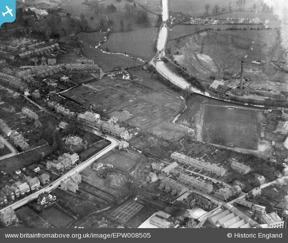
EPW008505 ENGLAND (1923). Raglan Street Glove Factory and environs, Worcester, 1923
© Copyright OpenStreetMap contributors and licensed by the OpenStreetMap Foundation. 2025. Cartography is licensed as CC BY-SA.
Nearby Images (6)
Details
| Title | [EPW008505] Raglan Street Glove Factory and environs, Worcester, 1923 |
| Reference | EPW008505 |
| Date | 1923 |
| Link | |
| Place name | WORCESTER |
| Parish | |
| District | |
| Country | ENGLAND |
| Easting / Northing | 384871, 256453 |
| Longitude / Latitude | -2.2214145572975, 52.205692974382 |
| National Grid Reference | SO849565 |
Pins

Daler |
Sunday 28th of July 2013 04:22:04 PM |


![[EPW008505] Raglan Street Glove Factory and environs, Worcester, 1923](http://britainfromabove.org.uk/sites/all/libraries/aerofilms-images/public/100x100/EPW/008/EPW008505.jpg)
![[EPW008506] Raglan Street and environs, Worcester, 1923](http://britainfromabove.org.uk/sites/all/libraries/aerofilms-images/public/100x100/EPW/008/EPW008506.jpg)
![[EPW008503] Raglan Street and environs, Worcester, 1923](http://britainfromabove.org.uk/sites/all/libraries/aerofilms-images/public/100x100/EPW/008/EPW008503.jpg)
![[EPW008501] Raglan Street and environs, Worcester, 1923](http://britainfromabove.org.uk/sites/all/libraries/aerofilms-images/public/100x100/EPW/008/EPW008501.jpg)
![[EPW008502] Raglan Street Glove Factory and environs, Worcester, 1923](http://britainfromabove.org.uk/sites/all/libraries/aerofilms-images/public/100x100/EPW/008/EPW008502.jpg)
![[EPW008504] Raglan Street and environs, Worcester, 1923](http://britainfromabove.org.uk/sites/all/libraries/aerofilms-images/public/100x100/EPW/008/EPW008504.jpg)