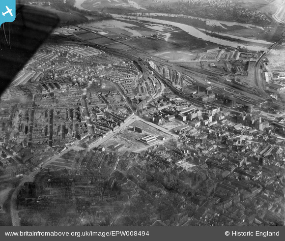
EPW008494 ENGLAND (1923). Manvers Street and environs, Nottingham, 1923
© Copyright OpenStreetMap contributors and licensed by the OpenStreetMap Foundation. 2026. Cartography is licensed as CC BY-SA.
Nearby Images (11)
Details
| Title | [EPW008494] Manvers Street and environs, Nottingham, 1923 |
| Reference | EPW008494 |
| Date | 1923 |
| Link | |
| Place name | NOTTINGHAM |
| Parish | |
| District | |
| Country | ENGLAND |
| Easting / Northing | 458174, 339659 |
| Longitude / Latitude | -1.134050104452, 52.950839365358 |
| National Grid Reference | SK582397 |
Pins

KC |
Saturday 21st of September 2024 06:24:49 PM | |

KC |
Saturday 21st of September 2024 06:23:25 PM | |

KC |
Saturday 2nd of October 2021 09:17:48 AM | |

KC |
Friday 21st of August 2020 01:11:52 PM | |

NorthChurch |
Friday 1st of May 2020 01:44:38 PM | |

NorthChurch |
Friday 1st of May 2020 01:42:31 PM |


![[EPW008494] Manvers Street and environs, Nottingham, 1923](http://britainfromabove.org.uk/sites/all/libraries/aerofilms-images/public/100x100/EPW/008/EPW008494.jpg)
![[EPW008495] Manvers Street and environs, Nottingham, 1923](http://britainfromabove.org.uk/sites/all/libraries/aerofilms-images/public/100x100/EPW/008/EPW008495.jpg)
![[EPW008500] Manvers Street Hosiery Works and environs, Nottingham, 1923](http://britainfromabove.org.uk/sites/all/libraries/aerofilms-images/public/100x100/EPW/008/EPW008500.jpg)
![[EPW008486] Hosiery Works on Manvers Street and environs, Nottingham, 1923](http://britainfromabove.org.uk/sites/all/libraries/aerofilms-images/public/100x100/EPW/008/EPW008486.jpg)
![[EPW008496] Manvers Street Hosiery Works and environs, Nottingham, 1923](http://britainfromabove.org.uk/sites/all/libraries/aerofilms-images/public/100x100/EPW/008/EPW008496.jpg)
![[EPW008497] Manvers Street Hosiery Works and environs, Nottingham, 1923](http://britainfromabove.org.uk/sites/all/libraries/aerofilms-images/public/100x100/EPW/008/EPW008497.jpg)
![[EPW008499] Manvers Street Goods Station and environs, Nottingham, 1923](http://britainfromabove.org.uk/sites/all/libraries/aerofilms-images/public/100x100/EPW/008/EPW008499.jpg)
![[EPW008498] Manvers Street Goods Station and environs, Nottingham, 1923](http://britainfromabove.org.uk/sites/all/libraries/aerofilms-images/public/100x100/EPW/008/EPW008498.jpg)
![[EPW053240] The Boots Pure Drug Co Drug Factory on Island Street, Nottingham, 1937](http://britainfromabove.org.uk/sites/all/libraries/aerofilms-images/public/100x100/EPW/053/EPW053240.jpg)
![[EPW053242] The Boots Pure Drug Co Drug Factory on Island Street, Nottingham, 1937](http://britainfromabove.org.uk/sites/all/libraries/aerofilms-images/public/100x100/EPW/053/EPW053242.jpg)
![[EPW055023] Nottingham Bus Depot on Lower Parliament Street and environs, Nottingham, 1937](http://britainfromabove.org.uk/sites/all/libraries/aerofilms-images/public/100x100/EPW/055/EPW055023.jpg)