
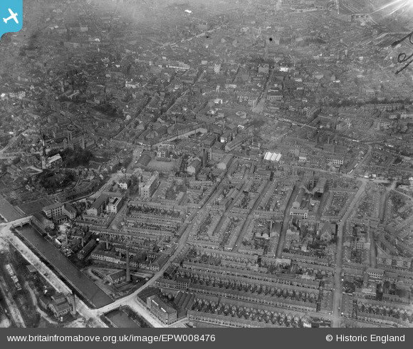
EPW008476 ENGLAND (1923). Oxford Street and environs, Leicester, 1923
© Copyright OpenStreetMap contributors and licensed by the OpenStreetMap Foundation. 2026. Cartography is licensed as CC BY-SA.
Nearby Images (12)
EPW008476

EPW008475

EPW008474

EPW008477

EPW008473

EPW018420

EAW051830

EPW020818

EPW020814

EPW020825

EPW020826

EPW055010

Details
| Title | [EPW008476] Oxford Street and environs, Leicester, 1923 |
| Reference | EPW008476 |
| Date | 1923 |
| Link | |
| Place name | LEICESTER |
| Parish | |
| District | |
| Country | ENGLAND |
| Easting / Northing | 458479, 304004 |
| Longitude / Latitude | -1.1358852810198, 52.630285423717 |
| National Grid Reference | SK585040 |
