
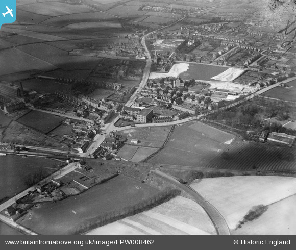
EPW008462 ENGLAND (1923). The Morley Hosiery Works and environs, Daybrook, 1923
© Copyright OpenStreetMap contributors and licensed by the OpenStreetMap Foundation. 2026. Cartography is licensed as CC BY-SA.
Nearby Images (9)
EPW008462

EPW008465

EPW008460

EPW008461

EPW020940

EPW020939

EPW008463

EPW008464

EPW008466

Details
| Title | [EPW008462] The Morley Hosiery Works and environs, Daybrook, 1923 |
| Reference | EPW008462 |
| Date | 1923 |
| Link | |
| Place name | DAYBROOK |
| Parish | |
| District | |
| Country | ENGLAND |
| Easting / Northing | 458025, 344742 |
| Longitude / Latitude | -1.1353562298288, 52.996547778155 |
| National Grid Reference | SK580447 |
Pins

KC |
Sunday 16th of July 2023 10:30:47 AM | |
|
KC |
Sunday 16th of July 2023 10:29:11 AM | |
|
pim-54 |
Saturday 26th of July 2014 05:57:57 PM | |
|
pim-54 |
Saturday 26th of July 2014 05:53:44 PM | |
|
pim-54 |
Saturday 26th of July 2014 05:49:27 PM |