
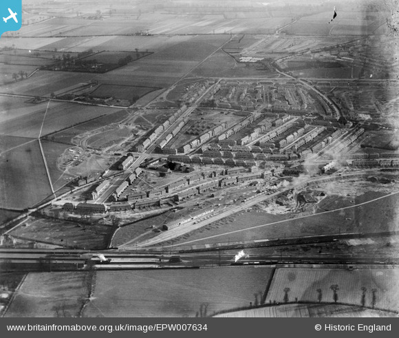
EPW007634 ENGLAND (1922). Mayfield Road and environs, Dagenham, 1922
© Copyright OpenStreetMap contributors and licensed by the OpenStreetMap Foundation. 2026. Cartography is licensed as CC BY-SA.
Nearby Images (4)
EPW007634

EPW007632

EPW006551

EPW007630

Details
| Title | [EPW007634] Mayfield Road and environs, Dagenham, 1922 |
| Reference | EPW007634 |
| Date | 23-March-1922 |
| Link | |
| Place name | DAGENHAM |
| Parish | |
| District | |
| Country | ENGLAND |
| Easting / Northing | 547539, 187230 |
| Longitude / Latitude | 0.12883650945463, 51.564143845498 |
| National Grid Reference | TQ475872 |
Pins

Ken Stanton |
Monday 8th of July 2019 05:33:23 PM | |
|
rac |
Saturday 2nd of August 2014 08:38:54 AM | |
|
rac |
Saturday 2nd of August 2014 08:38:08 AM | |
|
Martin |
Monday 10th of February 2014 11:11:42 AM | |
|
Katieb |
Thursday 30th of August 2012 07:53:31 PM |
User Comment Contributions
Chadwell Heath, Mayfield Road area |
John |
Monday 2nd of July 2012 03:09:24 PM |
Dear John, That’s great; we’ve reviewed your comments and thanks to your help we can update the catalogue. The revised record will appear here in due course. Katy Whitaker Britain from Above Cataloguer |
Katy Whitaker |
Monday 2nd of July 2012 03:09:24 PM |
Railway is obviously key to this town. Exporting what - Brick Clay ? Salt? Don't think it's Coal. |
BigglesH |
Tuesday 26th of June 2012 09:41:10 PM |