
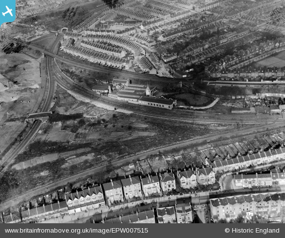
EPW007515 ENGLAND (1922). The Royal Standard Laundry and Acton Curve, Acton, 1922
© Copyright OpenStreetMap contributors and licensed by the OpenStreetMap Foundation. 2026. Cartography is licensed as CC BY-SA.
Nearby Images (11)
EPW007515

EPW007518
 Works, Acton, 1922")
EPW007519

EPW007517

EPW010678
 Works, Gunnersbury, 1924")
EPW010680
 Works, Gunnersbury, 1924")
EPW005265

EPW021918

EAW048453

EPW010679
 Works, Gunnersbury, 1924")
EPW021919

Details
| Title | [EPW007515] The Royal Standard Laundry and Acton Curve, Acton, 1922 |
| Reference | EPW007515 |
| Date | 10-February-1922 |
| Link | |
| Place name | ACTON |
| Parish | |
| District | |
| Country | ENGLAND |
| Easting / Northing | 520161, 178692 |
| Longitude / Latitude | -0.2688971669619, 51.493901226924 |
| National Grid Reference | TQ202787 |
Pins

roadrunner66 |
Wednesday 29th of October 2025 02:46:34 PM | |
 |
Leslie B |
Wednesday 18th of October 2023 02:01:52 PM |
|
roadrunner66 |
Friday 14th of June 2013 08:57:56 PM |