
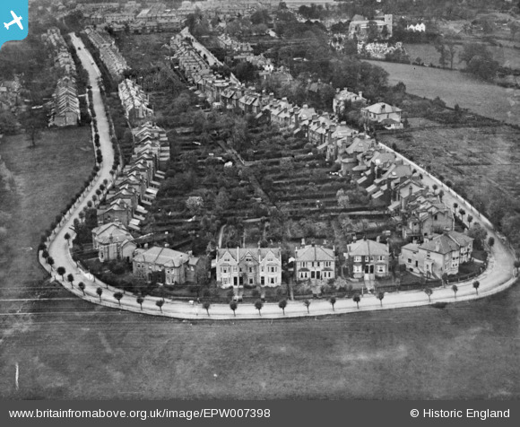
EPW007398 ENGLAND (1921). Sunningfields Crescent, Hendon, 1921. This image has been produced from a copy-negative.
© Copyright OpenStreetMap contributors and licensed by the OpenStreetMap Foundation. 2025. Cartography is licensed as CC BY-SA.
Nearby Images (2)
EPW007398

EAW004488

Details
| Title | [EPW007398] Sunningfields Crescent, Hendon, 1921. This image has been produced from a copy-negative. |
| Reference | EPW007398 |
| Date | 7-November-1921 |
| Link | |
| Place name | HENDON |
| Parish | |
| District | |
| Country | ENGLAND |
| Easting / Northing | 522942, 190038 |
| Longitude / Latitude | -0.22488811855918, 51.59528251893 |
| National Grid Reference | TQ229900 |
