
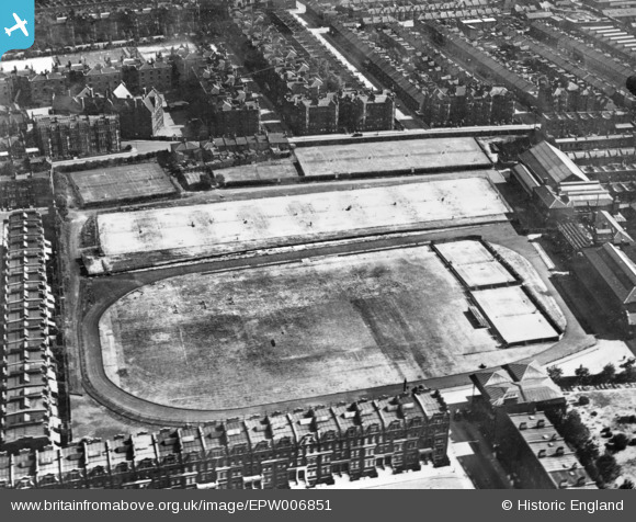
EPW006851 ENGLAND (1921). Queen's Club, West Kensington, 1921. This image has been produced from a print.
© Copyright OpenStreetMap contributors and licensed by the OpenStreetMap Foundation. 2026. Cartography is licensed as CC BY-SA.
Nearby Images (3)
EPW006851

EPW006854

EPW024247

Details
| Title | [EPW006851] Queen's Club, West Kensington, 1921. This image has been produced from a print. |
| Reference | EPW006851 |
| Date | 10-July-1921 |
| Link | |
| Place name | WEST KENSINGTON |
| Parish | |
| District | |
| Country | ENGLAND |
| Easting / Northing | 524283, 178010 |
| Longitude / Latitude | -0.2097842940253, 51.486880055302 |
| National Grid Reference | TQ243780 |
Pins

gBr |
Thursday 11th of August 2016 10:14:13 AM |