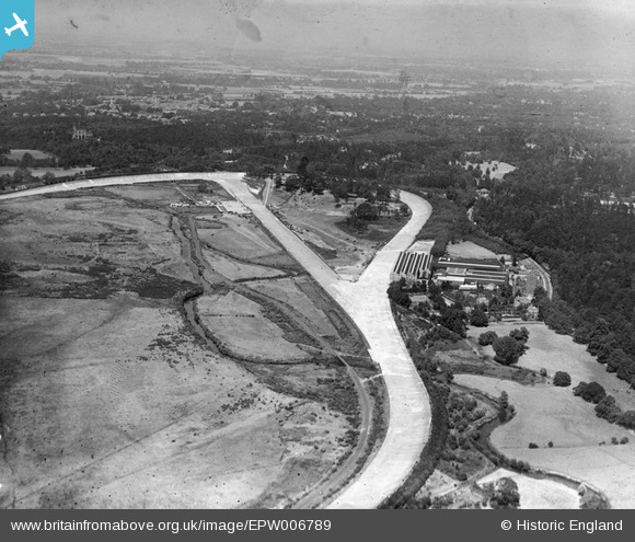
EPW006789 ENGLAND (1921). View over Brooklands, Weybridge, from the south, 1921
© Copyright OpenStreetMap contributors and licensed by the OpenStreetMap Foundation. 2026. Cartography is licensed as CC BY-SA.
Details
| Title | [EPW006789] View over Brooklands, Weybridge, from the south, 1921 |
| Reference | EPW006789 |
| Date | 25-June-1921 |
| Link | |
| Place name | WEYBRIDGE |
| Parish | |
| District | |
| Country | ENGLAND |
| Easting / Northing | 506895, 161919 |
| Longitude / Latitude | -0.46499569952706, 51.345786813225 |
| National Grid Reference | TQ069619 |
Pins

Class31 |
Wednesday 17th of December 2014 08:07:15 PM | |

flubber |
Wednesday 22nd of May 2013 06:47:54 PM | |

Roy Cousins |
Thursday 24th of January 2013 03:26:06 PM | |

Roy Cousins |
Monday 23rd of July 2012 01:12:24 PM | |

Roy Cousins |
Monday 23rd of July 2012 01:11:24 PM | |

Roy Cousins |
Monday 23rd of July 2012 01:10:01 PM | |

Roy Cousins |
Monday 23rd of July 2012 01:08:53 PM |
User Comment Contributions

Scorrybreck |
Sunday 16th of March 2014 10:27:19 PM |


![[EPW006789] View over Brooklands, Weybridge, from the south, 1921](http://britainfromabove.org.uk/sites/all/libraries/aerofilms-images/public/100x100/EPW/006/EPW006789.jpg)
![[EPW044003] A DH 80A Puss Moth (G-ABDI) owned by Germ Lubricants Ltd flying over Brooklands Airfield and Motor Course, Weybridge, 1934](http://britainfromabove.org.uk/sites/all/libraries/aerofilms-images/public/100x100/EPW/044/EPW044003.jpg)
![[EPW028329] Brooklands Motor Course and Airfield, Weybridge, 1929](http://britainfromabove.org.uk/sites/all/libraries/aerofilms-images/public/100x100/EPW/028/EPW028329.jpg)
