
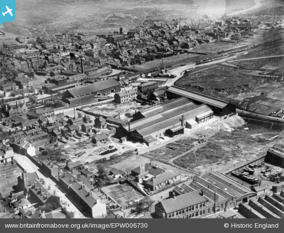
EPW006730 ENGLAND (1921). Holcroft's Steel Foundry and environs, Bilston, 1921. This image has been produced from a copy-negative.
© Copyright OpenStreetMap contributors and licensed by the OpenStreetMap Foundation. 2026. Cartography is licensed as CC BY-SA.
Nearby Images (21)
EPW006730

EAW013284

EAW013282

EAW013285

EPW050434

EAW013294

EPW050432

EPW050435

EPW050429

EPW050430

EPW050431

EAW013277

EPW050433

EAW013279

EAW013275

EAW013274

EAW013283

EAW013280

EAW013276

EPW015211

EAW013281

Details
| Title | [EPW006730] Holcroft's Steel Foundry and environs, Bilston, 1921. This image has been produced from a copy-negative. |
| Reference | EPW006730 |
| Date | June-1921 |
| Link | |
| Place name | BILSTON |
| Parish | |
| District | |
| Country | ENGLAND |
| Easting / Northing | 395083, 296192 |
| Longitude / Latitude | -2.0725443843537, 52.563177889649 |
| National Grid Reference | SO951962 |
Pins

dbm |
Friday 5th of April 2019 01:44:01 PM | |
|
meagain |
Saturday 29th of September 2018 07:01:21 PM | |
|
Ian |
Wednesday 21st of January 2015 07:58:10 PM | |
|
Ian |
Wednesday 21st of January 2015 07:50:58 PM | |
|
Ian |
Wednesday 21st of January 2015 07:50:10 PM | |
|
Ian |
Wednesday 21st of January 2015 07:49:41 PM | |
|
dbm |
Tuesday 6th of January 2015 02:53:01 PM | |
This isn't a glass making cone as there were none in Bilston, but I'm not sure what it is. |
Ian |
Wednesday 21st of January 2015 08:01:51 PM |