
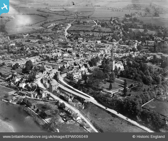
EPW006049 ENGLAND (1921). St Mary's Church and the town centre, Ross-on-Wye, from the north-west, 1921
© Copyright OpenStreetMap contributors and licensed by the OpenStreetMap Foundation. 2025. Cartography is licensed as CC BY-SA.
Nearby Images (9)
EPW006049

EPW006050

EPW039978

EPW029959

EPW039982

EPW039981

EPW058571

EPW058572

EPW058575

Details
| Title | [EPW006049] St Mary's Church and the town centre, Ross-on-Wye, from the north-west, 1921 |
| Reference | EPW006049 |
| Date | April-1921 |
| Link | |
| Place name | ROSS-ON-WYE |
| Parish | ROSS-ON-WYE |
| District | |
| Country | ENGLAND |
| Easting / Northing | 359678, 224106 |
| Longitude / Latitude | -2.5862821783496, 51.913587771774 |
| National Grid Reference | SO597241 |
Pins

Allan |
Monday 25th of August 2025 05:50:24 PM | |
|
Mixchief |
Friday 16th of May 2014 11:03:38 PM | |
|
Mixchief |
Friday 16th of May 2014 10:59:42 PM | |
|
Mixchief |
Friday 16th of May 2014 10:58:49 PM | |
|
Mixchief |
Friday 16th of May 2014 10:58:02 PM | |
|
robbyd |
Thursday 13th of September 2012 07:51:51 PM | |
|
robbyd |
Thursday 13th of September 2012 07:50:04 PM | |
|
robbyd |
Thursday 13th of September 2012 07:47:34 PM |