
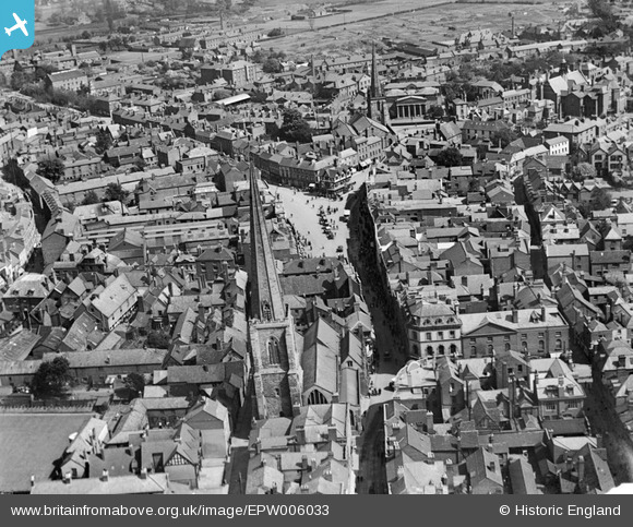
EPW006033 ENGLAND (1921). All Saints' Church and High Town, Hereford, 1921
© Copyright OpenStreetMap contributors and licensed by the OpenStreetMap Foundation. 2026. Cartography is licensed as CC BY-SA.
Nearby Images (7)
EPW006033

EPW006035

EPW029947

EPW029944

EPW029943

EPW029956

EPW029946

Details
| Title | [EPW006033] All Saints' Church and High Town, Hereford, 1921 |
| Reference | EPW006033 |
| Date | 30-April-1921 |
| Link | |
| Place name | HEREFORD |
| Parish | HEREFORD |
| District | |
| Country | ENGLAND |
| Easting / Northing | 350990, 240031 |
| Longitude / Latitude | -2.7148721324653, 52.056073557685 |
| National Grid Reference | SO510400 |
Pins

Brian Humphreys |
Monday 18th of February 2013 06:50:27 PM |
User Comment Contributions

All Saints' Church and High Town, Hereford, 1921 |
Hollybush |
Wednesday 27th of June 2012 07:35:22 PM |