
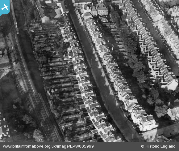
EPW005999 ENGLAND (1921). Dyne Road, Kilburn, 1921. This image has been produced from a print.
© Copyright OpenStreetMap contributors and licensed by the OpenStreetMap Foundation. 2026. Cartography is licensed as CC BY-SA.
Nearby Images (3)
EPW005999

EPW008748

EPW052780

Details
| Title | [EPW005999] Dyne Road, Kilburn, 1921. This image has been produced from a print. |
| Reference | EPW005999 |
| Date | 1-May-1921 |
| Link | |
| Place name | KILBURN |
| Parish | |
| District | |
| Country | ENGLAND |
| Easting / Northing | 524616, 184280 |
| Longitude / Latitude | -0.20277305685833, 51.543161904023 |
| National Grid Reference | TQ246843 |
Pins
Be the first to add a comment to this image!