
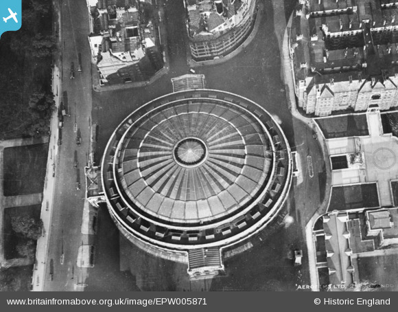
EPW005871 ENGLAND (1921). The Royal Albert Hall, Knightsbridge, 1921. This image has been produced from a copy-negative.
© Copyright OpenStreetMap contributors and licensed by the OpenStreetMap Foundation. 2026. Cartography is licensed as CC BY-SA.
Nearby Images (23)
EPW005871

EAW021737

EAW015829

EPW019016

EAW015830

EAW030305

EAW024007

EAW034723

EAW034724

EPW028626

EPW017275

EPW011937

EAW000553

EPW059339

EPW006192

EAW015853

EAW034725

EPW039570

EPW057068

EAW028803

EPW039571

EAW033442

EPW052910
, Westminster, from the south, 1937")
Details
| Title | [EPW005871] The Royal Albert Hall, Knightsbridge, 1921. This image has been produced from a copy-negative. |
| Reference | EPW005871 |
| Date | March-1921 |
| Link | |
| Place name | KNIGHTSBRIDGE |
| Parish | |
| District | |
| Country | ENGLAND |
| Easting / Northing | 526609, 179583 |
| Longitude / Latitude | -0.17573344765185, 51.500502039969 |
| National Grid Reference | TQ266796 |
Pins
Be the first to add a comment to this image!
User Comment Contributions
The Royal Albert Hall |

Alan McFaden |
Thursday 6th of November 2014 05:08:26 PM |

The Royal Albert Hall |
Alan McFaden |
Thursday 6th of November 2014 05:07:16 PM |