
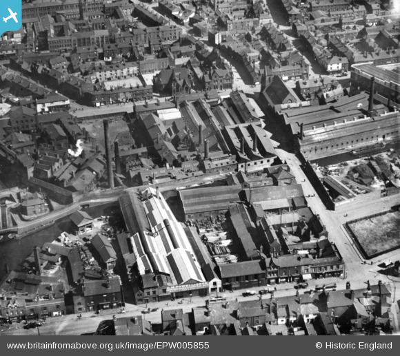
EPW005855 ENGLAND (1921). Industrial buildings along the Birmingham and Fazeley Canal near Love Lane, Birmingham, 1921. This image has been produced from a print.
© Copyright OpenStreetMap contributors and licensed by the OpenStreetMap Foundation. 2026. Cartography is licensed as CC BY-SA.
Nearby Images (6)
EPW005855

EPW041425

EPW041426

EPW041424

EPW041428

EPW041427

Details
| Title | [EPW005855] Industrial buildings along the Birmingham and Fazeley Canal near Love Lane, Birmingham, 1921. This image has been produced from a print. |
| Reference | EPW005855 |
| Date | March-1921 |
| Link | |
| Place name | BIRMINGHAM |
| Parish | |
| District | |
| Country | ENGLAND |
| Easting / Northing | 407741, 287965 |
| Longitude / Latitude | -1.8859826821559, 52.489176738831 |
| National Grid Reference | SP077880 |
Pins
Be the first to add a comment to this image!