
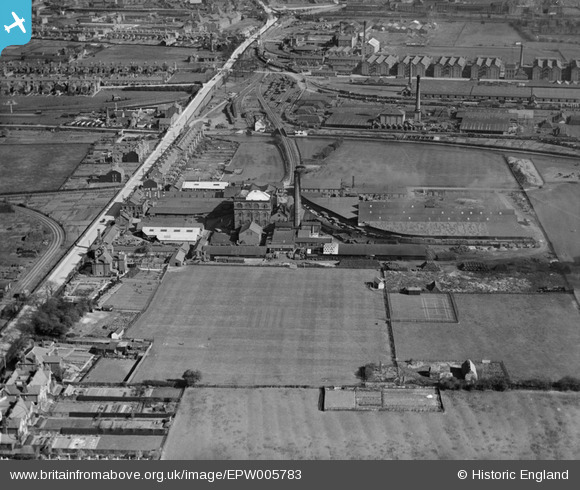
EPW005783 ENGLAND (1921). Marston's Brewery, Shobnall, 1921
© Copyright OpenStreetMap contributors and licensed by the OpenStreetMap Foundation. 2024. Cartography is licensed as CC BY-SA.
Nearby Images (12)
EPW005783

EPW005786

EPW005785

EPW005782

EPW005784

EPW047955

EPW047954

EPW047952

EPW047953

EPW047956

EPW047951

EPW047957

Details
| Title | [EPW005783] Marston's Brewery, Shobnall, 1921 |
| Reference | EPW005783 |
| Date | March-1921 |
| Link | |
| Place name | SHOBNALL |
| Parish | SHOBNALL |
| District | |
| Country | ENGLAND |
| Easting / Northing | 423052, 323342 |
| Longitude / Latitude | -1.6579971854797, 52.806804754865 |
| National Grid Reference | SK231233 |
Pins
Be the first to add a comment to this image!


