
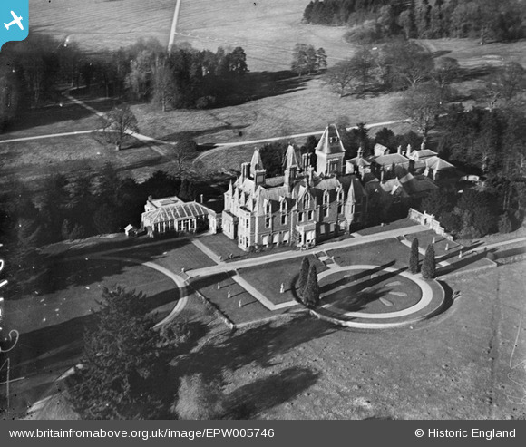
EPW005746 ENGLAND (1921). Addington Manor, Addington, 1921
© Copyright OpenStreetMap contributors and licensed by the OpenStreetMap Foundation. 2026. Cartography is licensed as CC BY-SA.
Nearby Images (7)
EPW005746

EPW005747

EPW005745

EPW005748

EPW008147

EPW005744

EPW005743

Details
| Title | [EPW005746] Addington Manor, Addington, 1921 |
| Reference | EPW005746 |
| Date | March-1921 |
| Link | |
| Place name | ADDINGTON |
| Parish | ADDINGTON |
| District | |
| Country | ENGLAND |
| Easting / Northing | 474613, 228491 |
| Longitude / Latitude | -0.91424975321664, 51.949471012941 |
| National Grid Reference | SP746285 |
Pins
Be the first to add a comment to this image!
User Comment Contributions
This house was demolished five years after this photo was taken |

AnthonyN8 |
Friday 12th of October 2012 03:43:25 PM |